Top 50 Apps Similar to Flone Remote
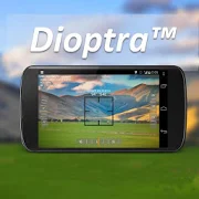
Dioptra™ Lite - a free camera tool 1.0.10
Dioptra™ Lite - a camera position and angle measurementtoolfornavigation, surveying, positioning, and measurement - -withover35,000 users! Stay tuned for an enhanced Dioptra app in2020withmore features, better sharing integration, andsupportingmorephones and devices! Instructions: Press the on-screencamerabuttonto save an image. View saved images in your device'sgalleryapp.[⊹] Dioptra™ Lite provides the following informationlikeatheodolite optical instrument - • yaw indicator (compass)•pitchindicator (tilt degrees) • roll indicator (tilt degrees)alongwith- • GPS position • azimuth and bearing to photo subjectTheancientgreek "dioptra" was a classical astronomicalandsurveyinginstrument, dating from the 3rd century BCE. Thedioptrawas asighting tube or, alternatively, a rod with a sight atbothends,attached to a stand. If fitted with protractors, it couldbeusedto measure angles. [⊹]
CartoDruid - GIS offline tool 0.60.16
CartoDruid is a GIS application developed by InstitutoTecnológicoAgrario de Castilla y León (ITACyL) thought as a tool tosupportthe fieldwork aiming to solve the problem of disconnectededitingof georeferenced information. In many field areas, mobilecoverageis insufficient to work in a reliable way. CartoDruidprovides asolution to this problem allowing the visualization onraster andvectorial layers stored on the device and allowing thecreation ofnew geometries (entities), drawing them directly on thescreen orusing embeded or external GPS. CartoDruid doesn't requierepreviousGIS (Geographic Information Systems) knowledge and it'seasy toconfigure and use. This allows any person to use it tomanagefieldwork information and then export generated data to usethem inexternal applications. What can CartoDruid do?: - VisualizeonlineGoogle Maps. - Use vectorial cartography loaded on aSpatiaLitedatabase. - USe rasterimaginery loaded on a RasterLitedatabase. -Consume online WMS services. - Create new layers on thedevice. -Configure filtering on vectorial layers to determinevisiblegeometries based on their attributes. - Configuresymbologies andlabels based on SQL expressions (easily). -Configure searches onlayers using SQL queries. - Configureidentification forms based onSQL queries. - Edit the attributes ofa geometry. - Manually drawgeometries: points, lines and polygons.- Draw and edit geometriesbased on GPS data. - Edit geometriesusing several useful tools:split using polyline, circular split,merge geometries, multipartexplosion. Graphically move existingvertices of geometries. -Create new geometries intersecting layers.- Automatically savegeorreferenced data: creating and update datesand others. -Associate pictures to entities. - SIGPAC search basedon existingdownloaded data. - Length and area measurement tools,defining themeasurement units. - Guided and line based navigationto help theuser reach her destination. - Manage bookmarks. - Importvectorialdata using CSV files. - Import SpatiaLite databases. -Exportseveral formats: SQLite, KML and CSV. - TOC (Table ofContents)management: sorting, symbologies, hierarchical sorting(folders). -Works with SHP (ESRI ShapeFile) as an exprimentalfeature. -Controlling the operations that can be performed on alayer viaconfiguration (overlaps. move vertices. deleteentities,identification and edition, ...) Go visitwww.cartodruid.es to seethe complete list, download examples andlearn how to start!
LandStar 7 7.3.5.1.20210526
Developed by CHC Technology Co., Ltd(www.chcnav.com), LandStar7isthe newest field-proven software solution for Android.Designedforhigh precision surveying and mapping tasks for youreverydaywork.If you are new to LandStar 7, you will be impressed byitsseamlesswork mode management, easy-to-use andeasy-to-learngraphical userinterface with simple operation.Extensive dataimport/exportformats and multiple types ofmeasurement and stakeoutmethodsensure instant productivity. TopFeatures: 1.One-buttonSwitchingDual Styles Simple Style, forentry-level surveyors, withbasicfunctions in one screen. ClassicStyle, for professionalsurveyors,with all functions showing indifferent tables based onthefrequently used work flow. 2.VariousBase Map Displays OSM,BING,Google, WMS online maps. DXF, SHP, TIF,SIT, KML, KMZ offlinemaps3.Extensive Import and Export Data FormatsImport from DXF,SHP,KML, KMZ, CSV, TXT and CGO formats. Export toDXF, SHP, KML,KMZ,RAW, HTML, CSV, TXT formats. Customized importand exportcontentsin CSV or TXT formats. 4.Various Types ofMeasurementSupportsstatic, RTK and stop & go measurement. 7methods ofpointmeasurement, including topographic point, controlpoint,quickpoint, continuous point, offset point, EBubblecompensatedpointand corner point. 5.Various PeripheralsSupportedPipelinedetector, VIVAX-METROTECH vLocPro2. Laserrangefinder,LeicaDisto,SNDWay and Bosch. Echo sounder,sonarmite,NMEA DPT andDBT.6.Convenient Work Mode ManagementPresetting common work modesofbase and rover, switching work modesby one button. Convenienttowork in stop&go based on real-timekinematic (RTK) modeandstatic mode can be set at the same time.7.Standard CGDcorrectionfile CHCNAV own CGD file for grid/geoidcorrection. Datumgrid,plane grid and height geoid files areintegrated in one CGDfile,and each CGD file name is correspondingto coordinatesystem.Multiple grid formats are available, GGF,BIN,GRT, GRD,GSF,GRI,BYN,ASC. 8.User-friendly Stakeout InterfaceTwo modesforstakeout, map mode shows the current position andtargetposition,compass mode shows the target direction. Users cansetNorth, Sunor point as a reference direction. 9.Multiple TypesofStakeoutPoint and line stakeout by snapping feature point onDXFbase mapor survey point. Surface stakeout with 3D DXF, XML,HCTformats.10.Correction Repeater Function Easily repeatingcorrectiondatafrom RTK network or radio mode to other rovers viaradio.RTCMTransformation Message Using RTCMtransformationmessages(1021-1027) for datum transformation,projection, automatedgridposition and geoid adjustments. 11.CHCNAVCloud Service Allowsforuploading and downloading projects,coordinate systems, workmodesand code lists. 12.Quick Data ShareUse Gmail, WhatsApp,GoogleDrive, Skype to share your data Shareyour projects,coordinatesystems, points, work modes, codes, reportsandresults.13.Powerful Road Functions Create road elements infield,perfectlymatch your design data. Support center line,crosssection,profile, slope, structure, culvert and stakes.Differentviews areavailable for stakes, slope, structure and datacheck.14.FieldHardware Support Supports CHC i90 with firmwarev2.0.11,i80/i70/M6receiver with the firmware v1.6.55, i50 receiverwith thefirmwarev1.0.38, X91+/X900+ receiver with the firmwarev8.39 andabove, aswell as internal GPS of Android smartphone andhandheldcontroller.15.Data Collection Hardware LandStar 7 used withCHCHCE320 is themost compatible way, it can also be used withCHCHCE300, LT600,LT700, LT700H or other Android devices of v4.2andabove.16.Language support LandStar7 is available inBulgarian,Croatian,English, Finnish, French, German, Greek,Hungarian,Iranian,Japanese, Kazakh, Korean, Persian, Polish,Portuguese,Russian,Simplified Chinese, Spanish, Slovak,Thailand,TraditionalChinese,Turkish,Mongolian and Vietnamese.
Partizan 21.08.21
You need just one app! Live-streaming and working with thearchiveispossible on one screen and on one time scale. It isafundamentallynew solution! European quality. Europeansafetystandards. Europeandevelopers. Add cameras and recorders inthemost convenient way foryou. The most comfortable color gamutforthe eyes. Saves the chargeof your device. It helps you tokeepcontrol of the objects for along time. Absolute compatibilitywithPartizan equipment. Technicalsupport:email:support@partizan.global skype: partizan-supportDevelopers:email:rd@partizan.global
Accurate Altimeter 2.2.32
The most downloaded Altimeter on the PlayStoreis now updated with a new interface and new features!- Altitude estimation with three different methods to be alwayssureto get a reliable measure, even without internetconnection.- Historical charts to see your excursions elevation gain.- Map with your elevation and contour lines.- Pictures with impressed place name and altitude.Altitude can be estimated:- With satellites triangulation. Slow and less accurate but itworkseven with no internet connection.- Taking the ground elevation at your current position fromaninternet web service.- Using the pressure sensor of your device (if available).Itcalibrates itself on pressure from the nearest weather stationtoimprove accuracy.As additional PRO features you can also:- compensate systematic error of pressure sensor- record altitude without opening the App- remove advertising
Nuwa 2.2.7.0
Nuwa is a survey & data collection App developed byTersusGNSSInc. With Nuwa you can connect Tersus David GNSSreceiverviaBluetooth or USB that turns any Android devices intoRTKbase,rover or GIS data collector. This App providesvariousbuilt-insurvey tools. Key Features: 1) AssistswithBluetooth/USBconnection 2) Configure base/rover setup 3)Visualizedinterfacefor receiver operations 4) Data management(import/export)
Bubble Level - Spirit Level
Bubble level also known as spirit level is a free,handy,accurate,simple to use and incredibly useful tool for yourAndroiddevice. Aspirit level or bubble level is an instrumentdesigned toindicatewhether a surface is horizontal (level) orvertical(plumb). Vialson modern level meter have a slightly curvedglasstube which isincompletely filled with a liquid, usually acoloredspirit oralcohol, leaving a bubble in the tube. Atslightinclinations thebubble travels away from the center position,whichis usuallymarked. Bubble Level app tries to mimic the reallevelmeter anddisplays the data as real level meter would. Anextensionof thespirit level is the bull's eye level: acircular,flat-bottomeddevice with the liquid under a slightlyconvex glassface with acircle at the center. It serves to level asurfaceacross a plane,while the tubular level only does so inthedirection of the tube.Bubble Level app tries to mimic therealbull's eye level anddisplays the data as real bull's eyelevelwould. Where any why useBubble Level? A bubble level is adeviceused in construction,carpentry and photography thatdetermines ifobjects on whichyou're working are level. Usedproperly, a bubblelevel can helpyou create flawlessly level piecesof furniture,staircases andhomes. A bubble level is also helpfulwhen setting upa tripod forphotographs or when hanging paintings orother items onthe wall.


