Top 50 Apps Similar to Daycation


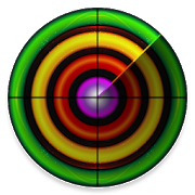
RadSat HD 1.0.13
RadSat HD is a weather app that allows the integration ofaweatherradar mosaic with GOES-16 satellite imagery,lightning,forecastsmaps and other products. You can view current orfutureweatherradar imagery from the United States, Europe,Australia,Argentina,Brazil and other countries. In addition,satelliteimagery, globallightning (requires subscription) and GFSproductscan be added.With a forecast, we can know the probabilityof rainorthunderstorms for a given day or hour, but with a weatherradarorsatellite, we can know the exact moment that will rain ineachareaand what risks can be expected (heavy lightning,hail,tornadoes,flash flooding). When lightning occurs near yourdevice'slocation,the app will notify you to seek shelter. Formoreinformation or tosuggest improvements, visittheExtendedForecast.net website or ourFacebookpage:/extendedforecast.

Go Outdoors Georgia 2.0.4
The Go Outdoors GA app is an official appofthe Georgia Department of Natural Resources' WildlifeResourcesDivision. This free, mobile app gives sportsmen andoutdoorenthusiasts essential information in the palm of their hand.Someof the Go Outdoors Georgia app features, including the huntingandfishing license download & sync, require Android version 4.4orgreater.Features include:Purchase and store fishing and hunting licenses(Android4.4+).Access to rules and regulations. Use geo-locating tools toenhanceyour recreational experience Wildlife Resources managesnearly 1million acres of public lands for wildlife and habitat inGeorgia.These WMAs are featured on the app.Version 2.0.4- Streamlined the Game Check Reporting Process- Improved notification messages- Minor bug fixes


Rain Alarm Pro
This weather app alerts you when rainisapproaching. The alerts are a reliable short-term forecast basedonnear real-time data. This app is more precise and reliable thanatraditional forecast.It is very useful for all outdoor activities – includingcycling,motorcycling, hiking, gardening, BBQs, picnics, dog walkingandDIY.Features:• Alerts to every type of precipitation, whether rain, snoworhail• Alert as a notification with vibration and/or sound• Simple and easy map overview• Handy widgets in different sizes and themesThe data is collected from governmental weather services. Worksinthe USA (including Alaska, Hawaii, Puerto Rico, Guam), Canada,theUK, Ireland, Australia, Bermuda, the Philippines, Finland,Iceland,Spain (including the Balearic and the Canary Islands),Argentina,Mexico, El Salvador, Taiwan, Macau, Hong Kong, Malaysia,Singapore,Brunei, Germany, Austria, Japan, Republic of Korea,Norway, theNetherlands, Slovenia, Croatia, Belarus, Ukraine.Includes all extra features:• No more ads• Multiple alarms and additional settings• Animation settings and overlay transparency• Multiple locations and additional settings• More widget color schemes• Activate the Android Wear app (adjustable and zoomable mapviewwith animation)Also available for other platforms:https://app.rain-alarm.comFollow us on Twitter for the latestnews:https://twitter.com/rainalarm


TrekMe - GPS trekking offline 3.2.6
TrekMe is an Android app to get live position on a map andotheruseful information, without ever needing an internetconnection(except when creating a map). It's ideal for trekking,biking, orany outdoor activity. In this application, you create amap bychosing the area you want to download. Then, your map isavailablefor offline usage (the GPS works even without mobiledata).Download from USGS, OpenStreetMap, SwissTopo, IGN (FranceandSpain) Other topographic map sources will be added. Fluidanddoesn't drain the battery Particular attention was giventoefficency, low battery usage, and smooth experience. SDcardcompatible A large map can be quite heavy and may not fit intoyourinternal memory. If you have an SD card, you can use it.Features •Import, record, and share GPX files • Marker support,with optionalcomments • Real-time visualization of a GPX record, aswell as itsstatistics (distance, elevation, ..) • Orientation,distance, andspeed indicators • Measure a distance along a trackFor instance,all map providers are free, except for France IGN -which requiresan annual subscription. During a GPX recording, theapp collectslocation data even when the app is closed or not inuse. However,your location will never be shared with anyone and gpxfiles arestored locally on your device. General TrekMeguidehttps://github.com/peterLaurence/TrekMe/blob/master/Readme.md


Slovenia Trails Hiking&Biking 2.4
Slovenia Trails is a new application for Slovenian hiking andbikingtrails. Application was developed in cooperation withcompanyMonolit d.o.o. and association Hiking&biking GIZ. It isa greattool for everyone who like to discover new places andenjoySlovenian beauties. The guide includes over 300 hiking andbikingtrails and data about special destinations for hikers andbikersthat are members of Slovenian Hiking and Biking association.Theguide covers the entire Slovenian territory. Trailsincludedetailed information as trail length, duration, descriptionof thetrail, picture of the trail blaze, elevation data withelevationprofile and interesting locations by the trail. Everytrail ischecked for availability for families and how manypercentage ofthe trail goes through the forest, main roads and sideroads. Somefeatures of the app: - Display of routes on a detailedtopographicmap (Monolit maps, used in different GPS navigationdevices), -enabled search through specialised hikers and bikersfriendlydestinations, - off line maps for easier and friendlier useof theapplication in the nature.


Fishing Times Free
This app offers an easy to read solunarfishingcalendar, tide times and sun/moon information to plan yourfishingtrips.The free version is ad supported and is limited to a 3dayforecast.How to read and use the App:- Green Bars indicate major and minor fishing times (majorlonger,minor shorter bar)- Blue Bars indicate low and high tide times.- Center indicates current moon phase- Grey line represents the current time- top right of screen has a day rating indicator ( 1-4 fishes,fairto excellent )- icons for sun/moon rise and set- swipe left or right to change datesPlease contact me if you have any suggestions forfurtherimprovements!This application is powered by http://www.fishingreminder.com


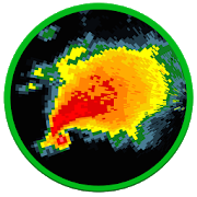
NOAA Weather International
Retrieve real-time 7-day hyperlocalpointweather forecasts and current weather conditions forworldwidelocations from NOAA NWS, Environment Canada & Dark Skybased onyour current location or any location in the world.Not only are NOAA forecasts the most accurate, they provideuniquepoint forecasts for every square mile which take intoconsiderationall the variables affecting the weather at that point,such asaltitude. This is especially useful in locations withhighlydynamic weather patterns and is a great tool forbeingoutdoors.-View forecast & current conditions for yourcurrentlocation.-View forecast & current conditions for any location intheworld by map.-Save favorite locations to quickly retrieve forecastsforthem.-Hourly forecast-Animated radar, cloud cover, precipitation & wind imageryoverGoogle Maps-Map measuring tool to measure distance and elevation-Hazardous weather alerts-Current conditions notification-Home screen widget-Light and Dark Material themes-Optimized for tablets-Android Wear supportIn-app purchase is available to remove ads.Please e-mail me below with any bug reports or featuresrequests.Thanks!