Top 25 Apps Similar to V-Navi

NUNAV Navigation 2.940.54b89
NUNAV is a navigation system withrevolutionaryrouting. An intelligent swarm algorithm distributesallparticipating cars across the available infrastructure.Thisprevents traffic jams and gets everyone to theirdestinationquicker.NUNAV always provides the route that is ideal for you. By usingthesystem continuously, it also helps other users get betterroutes,too. If enough users participate the travel time for eachdrivercan be reduced by up to 25%.Try it! Give us feedback! Recommend it! The more people join,thebetter the routes get.Don't be the traffic jam!


Navmii GPS World (Navfree) 3.7.22
Navmii is a free navigation and traffic appfordrivers.Navmii combines FREE voice-guided navigation, livetrafficinformation, local search, points of interest and driverscores.Offline maps stored locally, for use without aninternetconnection. Over 24 million drivers use Navmii and our mapsareavailable for more than 150 countries.• Real voice-guided navigation• Real-time traffic and road information• Works with GPS only – internet not needed• Offline and Online Address search• Driver Scoring• Local Place search (powered by TripAdvisor, FoursquareandWhat3Words)• Fast routing• Automatic rerouting• Search using Postcode/ City/ Street/ Points of interest• Heads-Up Display (HUD) – upgrade• Community map reporting• HD accurate maps• + Much, much moreWe have thousands of 5-STAR REVIEWS:- why buy a satnav when navmii does it all- unbeatable value and functionality- love, love this app!Navmii features on-board OpenStreetMap (OSM) maps, which arestoredon your device and therefore you don’t need no dataconnection(unless of course you use the connected services). UseNavmiiabroad to avoid high roaming costs!We're always eager to hear about your experience of usingNavmii.You can contact us anytime by email, on Twitter or Facebookusingthe details below:- Twitter: @NavmiiSupport- Email: Support@navmii.com- Facebook: www.facebook.com/navmiigpsNote: continued use of GPS running in the backgroundcandramatically decrease battery life.


Blitzer & Radarwarner 1.1.1
Carmunis Verkehrs- und Radarwarner für mehrSicherheitimStraßenverkehr. Das moderne Design, ein zusätzlicherGPS-TachoundBussgeldrechner machen die App zu einem MußfürjedenFahrzeugführer. ★ über 90.000 Blitzer- und Gefahrenpunkte-Warnungvor festinstallierte Blitzer - Warnung vor mobile Blitzer-Warnungvor Verkehrskontrollen - Warnung vor BAG Kontrollen-Warnung vorGefahrenstellen - Warnung auch im Offline Modus(z.B.beiAuslandsfahrten oder Funklöcher) ★ AnzeigeBlitzersymboleoderSmileys - optische Warnung durch BlitzersymboleoderunauffälligeSmileys einstellbar ★ Hintergrundbetrieb -verwendenSie Carmunismit anderen Anwendung gleichzeitigimHintergrundbetrieb - derHintergrundbetrieb ermöglichtauchWarnungen bei ausgeschaltetemDisplay ★ GPS-basierter Tacho-modernes Design mit GPS basierterGeschwindigkeitsanzeige-Anzeigemöglichkeiten in km/h oder mph ★BußgeldrechnerfürDeutschland - errechnen Sie das Bußgeld fürVerkehrsverstöße★Zugang zur Carmunisgemeinschaft - Melden SieKontroll-oderGefahrenpunkte und profitieren Sie von Meldungenanderer Nutzer★Bußgeld und Kosten sparen (Premiumversion) -einmaliger Kaufpreis-keine monatlichen Kosten oder Abo ★ aktiveundgeprüfteBlitzeranzeige (Premiumversion) - aktive ErkennungvonmobilenGeschwindigkeitskontrollen (auch im Offline-Modus)-geprüftePremiumdaten ★ Widget Funktion (Premiumversion) - legenSieeinkleines Informationsfenster (Widget) über andereAnwendungen(z.B.Google Navigation) - das Widget kann an einebeliebge StelleamDisplay platziert werden ★ Querformat Anzeige(Premiumversion)-wahlweise Ansicht im Hoch- oder Querformat


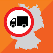
Sygic Truck & RV GPS Navigation 21.3.0
High-quality GPS navigation designed for professional drivers&their large vehicles. Trusted by 3 million drivers ofTrucks,Camions, HGVs, RVs, Caravans, Campers, Vans, Buses, Cars& manyof the world’s leading delivery fleets. Lots of smartfeatures,beautiful 3D offline maps, and easy to use interfaceprovide aproductive and enjoyable navigation experience. SygicTruck GPSNavigation is the best copilot on your routes! TRUCKSPECIFIC MAPS& ROUTING • Special routing for Truck / Camion /LGV / HGV/Delivery Van calculated for the vehicle & load. •High quality3D offline maps. Free map updates several times peryear. Maps arestored offline on your device so internet connectionis notrequired, works with GPS signal. • 3 route alternativesaredisplaying total time, distance, and elevation of the route.•Profiles for 3 different trucks. Set the parameters suchasdimensions, weight, transported material (HAZMAT), numberoftrailers, and the app will select the best route for the vehicle.•Last-mile functionality displaying restricted part of the routeina different color POIs • Millions of Truck specific PointsofInterests • Include gas stations, weigh stations, and restareas.PROFESSIONAL PLANNING & OPTIMALISATION • Advancedrouteplanning to avoid toll roads, U-turns, hazards such as lowbridges,narrow roads, or restricted areas (emission zones, schoolzones).Set preferences such as right turns or arrival with thedestinationon the right side. • Plan & optimize your Multi-Stoproute. Addup to 150 waypoints, and they will be re-arranged toachieve thebest efficiency. • Plan your route with Google Maps& easilydispatch to the app with Sygic Truck Route Sender -free extensionin Chrome and Firefox browser. DESIGNED FOR RV /CARAVAN / CAMPER /BUS • Profile configuration for RV / Caravan /Camper / Motorhome /Bus • Special routing for RV / Caravan / Camper/ Motorhome / Buscalculated for the vehicle & load. • Routesand directionsdesigned for RVs based on your vehicle size • RVspecific POIs:Campgrounds, parking stations, rest areas and moreSAFETY FEATURES• Spoken voice instructions with road indication •Dynamic LaneAssistant & Junction View • Speed Limits &Speed CamerasWarnings ADD-ONS • Live Services include Real-timeTrafficinformation + Mobile Speed Cameras Database + Fuel Prices +ParkingPlaces • Head-Up Display (HUD): Projects navigationinstructionsonto your windshield AVAILABLE MAP REGIONS • NorthAmerica • Europe(with Russia) • Australia & New Zealand •Brazil • Middle East• Africa You can test-drive Premium feature forthe first 14 daysafter installation. After 14 days, you cancontinue using the basicfeatures or upgrade to the Premium license.Also available fromSygic: Should you have any questions, pleasevisitsygic.com/support. We are here for you 7 days a week. If youlikeour app, please leave a review. Thank you for your support.PrivacyPolicy: www.sygic.com/company/privacy-policy Terms ofUse:www.sygic.com/company/terms-of-use By installing, copying orusingall or any portion of this software you accept all the termsandconditions of this agreement: https://www.sygic.com/company/eula


Vaarkaart Friese Meren 2.11
The perfect chart for sailing on theFrisianlakes. This chart is made for boat renters, skippers andcrew ofsail boats, motor boats and barges. Also recommended forcanoes andfishers.AreaFrom Stavoren to Grouw, with the following lakes::Heegermeer,Fluessen, Morra, Oudegaster Brekken, Zwarte and WitteBrekken,Sneekermeer, Koevorden, Tjeukermeer, Langweerderwielen,andPikmeer/Wijde Ee.This is a detailed chart with a scale 1,3m/pixel. This comesdownto about 1 : 5000 on the screen.Depth viewWith clear depth view from the Friese Meren Project in wellcoloreddepth areas on the lakes and depth numbers along the waterways.Developed by Stentec in cooperation with the province Fryslânbasedon the most recent depth measurements.WaypointsThe included database contains 2345 waypoints divided in 13groups.The 145 marinas show phone numbers and websites. Othergroups areamong others bouyage, mooring spots, campings and gasstations.The accurate positioned bouyage contains the socalled‘slobbers’. These mark the protected bird area from 1 Octoberto 1May. Outside this period these are replaced by yellowregattabuoys.Marrekrite 2014 natural mooring places are also included inthechart. You can easily see if camping is allowed (CAMP), ifacontainer is present (CONT) or if you can moor (WAL).The bridges and locks along the water ways are shown withheightand width so you can easily plan your route. The manyaquaducts arealso shown. Most bridges are operated daily from 1 Mayto 1November from 9h-19h. In June, July and August even until20h.