Top 50 Apps Similar to Interactive Hurricane Tracker
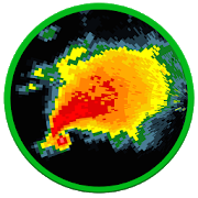
Hurricane Tracker 1.1
After launching on iOS almost 10 years ago, HurricaneTrackerhasfinally made it's way into the Google Play store!Reviewed byCNNas the best Hurricane Tracking app. GOOGLE: "cnn tophurricaneapp"to read the article! Hurricane Tracker is the mostused &mostcomprehensive tracking app available on any platform.WhatmakesHurricane Tracker different from the others in theGooglePlayStore: • Receive push alerts (by region) when a new stormformsorthreatens landfall • 65+ maps/images • In-depthwrittendiscussionsand analysis from our team • Real timeNationalHurricane CenterUpdates (All NHC advisories & maps) •Audiotropical updates •Storm video updates • Custom graphics fromourteam of experts.Exclusive “Alert Level” & “ImpactPotential”maps. Not justbasic NHC info. • Share informationwithfriends/family via email,SMS, Facebook & Twitter •Superdetailed tropical wave/investinformation • Dozens ofsatellites •Much, much more! There is noother Hurricane trackingapp out therethat can match the amount ofinformation you get-weguarantee it.Get the information you needto make informeddecisions. We chargefor our app because it’s notjust an automatedproduct, our team isconstantly creating graphics& writingdetailed discussions tokeep you informed. This isour full time job- keeping you ahead ofthe storms. NOTE*** We donot offer refunds onour app after thestandard Google trialwindow. All sales final.Hurricane Trackercovers The Gulf ofMexico, Caribbean, AtlanticOcean & EasternPacific. Our appalso covers any storms that mayaffect Hawaii. Wedo not coverstorms near Australia and the WesternPacific. CONTACTUS WITH ANYQUESTIONS: Web: www.hurrtracker.comEmail:support@ezappsinc.comTwitter: @hurrtrackerapp (live, realtimeupdates) *HurricaneTracker is an extremely dataintensiveapplication. A WiFi orstrong cellular signal isrecommended for thebest experience.


RadSat HD 1.0.13
RadSat HD is a weather app that allows the integration ofaweatherradar mosaic with GOES-16 satellite imagery,lightning,forecastsmaps and other products. You can view current orfutureweatherradar imagery from the United States, Europe,Australia,Argentina,Brazil and other countries. In addition,satelliteimagery, globallightning (requires subscription) and GFSproductscan be added.With a forecast, we can know the probabilityof rainorthunderstorms for a given day or hour, but with a weatherradarorsatellite, we can know the exact moment that will rain ineachareaand what risks can be expected (heavy lightning,hail,tornadoes,flash flooding). When lightning occurs near yourdevice'slocation,the app will notify you to seek shelter. Formoreinformation or tosuggest improvements, visittheExtendedForecast.net website or ourFacebookpage:/extendedforecast.


NOAA Weather International
Retrieve real-time 7-day hyperlocalpointweather forecasts and current weather conditions forworldwidelocations from NOAA NWS, Environment Canada & Dark Skybased onyour current location or any location in the world.Not only are NOAA forecasts the most accurate, they provideuniquepoint forecasts for every square mile which take intoconsiderationall the variables affecting the weather at that point,such asaltitude. This is especially useful in locations withhighlydynamic weather patterns and is a great tool forbeingoutdoors.-View forecast & current conditions for yourcurrentlocation.-View forecast & current conditions for any location intheworld by map.-Save favorite locations to quickly retrieve forecastsforthem.-Hourly forecast-Animated radar, cloud cover, precipitation & wind imageryoverGoogle Maps-Map measuring tool to measure distance and elevation-Hazardous weather alerts-Current conditions notification-Home screen widget-Light and Dark Material themes-Optimized for tablets-Android Wear supportIn-app purchase is available to remove ads.Please e-mail me below with any bug reports or featuresrequests.Thanks!


Storm Radar: Hurricane Tracker, Live Maps & Alerts
Storm Radar is your NOAA forecast, weather radarandhurricanetracker with severe weather alerts. Stay safe andinformedthroughrain and severe weather using 8 hour past to futureradar,livewind speed, NOAA radar and tornado updates. Get readyforstormseason with live wind speed and tornado updates fromTheWeatherChannel. Rain and floods tracker, wind speed andlocaltemperature,our cutting-edge doppler radar technology letsyoucustomize yourHD weather map in real-time with GPSlocalization.Plus, get livesevere weather alerts, including floods,lightningand hourlytornado updates from your NOAA storm radar andhurricanetracker.Plus, Storm will give you tornado alerts andhourly NOAAforecastin real-time (or up to 8 hours in advance) withour radarHDweather map. Storm offers you weather like you'veneverseenbefore. Storm Radar Maps, Tornado Alerts &HurricaneTracker:TOP 3 FEATURES 1. GPS weather map and NOAAforecast in realtime:view doppler radar imagery of severe weatherpatterns,includingwind speed, lightning and rain. 2. Future radarmaps: yourweathermap, storm radar and hurricane tracker predictslocaltemperature,risks of floods and hourly tornado trajectories upto 8hoursbefore the storm hits. 3. Live severe weather alertswithStorm:stay safe and track real time tornado updates andhurricanealertsfrom The Weather Channel. Your storm tracker keepsyou inwith ourstorm radar and hurricane alerts. • The Storm futureradartoolgives you data on all impending storms. Find outwindspeed,lightning, flood warnings and much more. • Weather radarmapsarecustomizable with detailed data overlays,includinglocaltemperature and seismic activity. Get live weatheralerts fromTheWeather Channel. • Track rain with real timeprecipitationupdatesfor your area. • When lightning strikes, beaware: yourhurricanetracker sends live lightning alerts for yourGPS location.Chasethe perfect storm with your tornado tracker, orget homebefore therain starts. Storm uses cutting-edge dopplerradar tohelp you tostay safe and informed in any weather. Find alltheweathers mapsyou need to stay safe, and unlock and track evenmoremaps andhourly visualizations with our ad-free version.*Continueduse ofGPS running in the background can dramaticallydecreasebatterylife ---------- THE WEATHER CHANNEL: WEB &SOCIAL MEDIAForgotyour phone? Access Future Radar and many of thetop appfeatures onthe web, wherever you go. Find us on theWeb:weather.com Like uson Facebook:facebook.com/theweatherchannelFollow us on Twitter:@weatherchannelPERMISSIONS In order toprovide personalized localweather data,alerts, and forecasts, TheWeather Channel app needspermission toaccess your location.


VesselFinder Pro 4.1.4
VesselFinder is the most popular vessel tracking app,providingreal-time data on the positions and movements of vessels,utilisinga large network of satellites and terrestrial AISreceivers.VesselFinder features include: - Real-time tracking ofover 200,000ships every day - Ship search by Name, IMO number orMMSI number -Ship movement history - follow the track of eachvessel for thepast 7 days - Ship details - name, flag, type, IMO,MMSI,destination, ETA, draught, course, speed, gross tonnage, yearofbuilt, size and more - Port search by Name or LOCODE - PortCallsper ship – time of arrival and stay in ports - Port Calls perport– detailed list of all vessels Expected, Arrivals, Departuresandcurrently In Port - My Fleet - add your favourite vessels to"MyFleet" list and even split them in groups. It is syncedwithVesselFinder.com, so any change of vessels in My Fleet listwillreflect on either the mobile App or the website. - My Views -savefavourite views of the map, so you can easily navigate to them-Ship photos contributed by VesselFinder users Coverage -near-shorecoverage, same as the website VesselFinder.com and theFree versionof VesselFinder availableathttps://play.google.com/store/apps/details?id=com.astrapaging.vffIMPORTANT:If you experience any problem with the App, please fillthis form tocontact us http://www.vesselfinder.com/contact insteadof writing areview here. We will do our best to solve it. Thanks!Visibility ofvessels in the App depends on AIS signalavailability. If aparticular vessel is out of our AIS coveragezone, VesselFinderdisplays her last reported position and updatesit as soon as thevessel comes into range. Completeness andaccuracy of theinformation provided cannot be guaranteed. Connectwith VesselFinder- on Facebook:http://www.facebook.com/vesselfinder - onTwitterhttp://www.twitter.com/vesselfinder

MyRadar Weather Radar
MyRadar is a fast, easy-to-use,no-frillsapplication that displays animated weather radar aroundyourcurrent location, allowing you to quickly see what weatheriscoming your way. Just start the app, and your location pops upwithanimated weather!The map has the standard pinch/zoom capability which allows youtosmoothly zoom and pan around the United States and see whattheweather is like anywhere.MyRadar shows animated weather, so you can tell if rain isheadedtoward or away from you, and how fast.In addition to the free features of the app, a fewadditionalupgrades are available; see severe storm warnings foryour area, asprovided by the National Weather Service, andreal-time hurricanetracking - great for the start of hurricaneseason!Download MyRadar today and try it out!


Disaster Alert
Disaster Alert (by PDC), Active Hazards onaninteractivemap and in a list as they are occurring around the globe.Additional hazard information can be viewed and shared.The term "Active Hazards" refers to a collection of currentandreal-time incidents (compiled from authoritative sources)whichhave been designated "potentially hazardous to people,property, orassets" by the PDC DisasterAWARE™ application.The application is a free download.PDC Active Hazards currently includes:-Hurricane/Tropical Cyclone (global)-Earthquake (global)-Flood (global)-National Weather Service High Surf (for Hawaii)-National Weather Service High Wind (for Hawaii)-National Weather Service Flood (for Hawaii)-Manmade (global)-Marine (global)-Storm (global)-Tsunami (global)-Volcano (global)-Wildfire (global)- coming soon!Other hazards will be added over time.Application features include:√ View Active Hazards on an interactive map or in theAlertlist√ Search for location (quick zoom)√ Choose background map√ Get "more info" for most Active Hazards√ Receive automatic updates every five minutes√ Choose a preferred time zone


Florida Storms 2.0.8
Everything you need, nothing you don't.FloridaStorms is not just another weather app with a radar. It's acleanand fast interactive map that alerts you to every storm,while atthe same time delivers credible real-‐time audio and textalertsfrom the Florida Public Radio Emergency Network. Using acombinationof Baron's exclusive storm track algorithms and theexpertise of ameteorologist, you're certain to receive the mostup-to-dateinformation on any potential weather hazard.View the latest tropical weather updates from the NationalHurricaneCenter, find your nearest evacuation route, check ifyou're in thepath of a dangerous storm surge, or just review achecklist of itemsyour family should have in case of a weatheremergency. Once youhave Florida Storms, you won't need multipleapps to prepare for thenext "big one". Whether it's just a routinepop-up shower thatmight send you indoors or a major hurricanethreatening yourneighborhood, Florida Storms is the simplest andfastest way to stayinformed of mother nature's next move.Features of Florida Storms:• Live radio stream of the nearest Florida Public RadioEmergencyNetwork partner station, with option to choose from 12others inthe state in case of evacuation or traveling• Customizable push notifications from multiple sources,includingthe National Weather Service, the National HurricaneCenter,Baron's exclusive Doppler radar, and local emergencymanagementpersonnel• Able to set location to other cities to track weatherthroughoutthe state and to get warnings for those locations• Watch and warning information from the National WeatherService,with the ability to view the advisory text and radar at thesametime• Fast and clean national radar, with 1-‐hour past loop• Option to load the nearest high-‐resolution Doppler radarinFlorida, also with 1-‐hour loop• Real-‐time lightning data, including positive strikes• National Hurricane Center storm track's and forecasts• Future radar up to 48 hours, with option to pause/play• Current temperatures and wind speeds• Multiple feeds of real-‐time information from varioussources,such as the nearest National Weather Service office, theNationalHurricane Center, Florida Department of Transportation, theFPRENStorm Center and local emergency management offices• Preparedness information for a weather disaster, including whattodo before, during, and after a stormFlorida Storms is completely free and developed by theFloridaPublic Radio Emergency Network, in partnership withMobiquity, Inc.Updates from the FPREN Storm Center are provided bya team of staffmeteorologists at the University of Florida Collegeof Journalismand Communications, and are also available on yourlocal Floridapublic radio station's website or over the air.The Florida Public Radio Emergency Network partners stationsareWUWF (Pensacola), WFSU (Tallahassee), WKGC (Panama City),WUFT(Gainesville), WJCT (Jacksonville), WMFE (Orlando), WMNF andWUSF(Tampa-‐St. Petersburg), WFIT (Melbourne), WQCS (Ft. Pierce),WGCU(Ft. Myers), and WLRN (Miami). Repeater stations includeWJUF(Inverness), WMKO (Marco), WUCF (Orlando), WFSQ (Tallahassee),andWXEL (Miami). More information about the Florida PublicRadioEmergency Network can be found at www.floridastorms.org.


AirMate 1.7.1
Airmate is a free and easy to use application for pilots,providinghelp for flight planning and navigation, and includingmany socialsharing features. Thanks to Airmate flight planningtools, you willget instant access to airport data and aviation mapsworldwide andup to date weather and NOTAMs. IFR and VFR airportplates arefreely available in US (FAA charts), all Europe, and morethan 200other countries. Many of them are georeferenced and couldbeoverlaid on the aviation chart. A powerful Plate Manager allowstodownload in advance all airport plates in a country, they couldbeeasily printed and viewed. During the flight, the moving mapwilldisplay the aircraft location along the route, show airportsandaeronautical data details. A profile view is available todisplayterrain elevation across the route. Airmate includes aworldwideaeronautical database updated free of charge withairports,navigation beacons, waypoints, airways, regulated andrestrictedareas. Topographic maps and elevation data for mostcountries maybe downloaded free of charge, as well as additionalaviation mapoverlays such US Sectionals. Airmate will also recordyour flightsand allow to replay them later or export the flightpath in gpxformat. A Satellite map display mode in flight planningor replaymode allows to familiarize with significant landmarks.Airmate willsave planned and flown flights, user waypoints and useraircraftsin the cloud and sync them between your devices. Airmatebringsnumerous social features to the community. Pilots mayleaveratings, tips and comments to share their experience withfellowpilots, and report fuel prices and landing fees. They couldfindfriends, instructors, flight schools, aviation events andaircraftto rent near their home airport or any visited airport.