48 Похожие Yacht Check


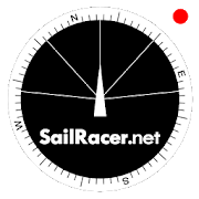
Sail Racer 6.6.4
This is a sail racing app for sailing enthusiastsandprofessionals.Application is used as an additional tool nexttostandard yachtequipment to take tactical sail decisionsfaster.Sail Racer appsuggest the favored end of the start line,monitorsyour position,time and guides the maneuvers that the startlinewas hit at thelast moment with the best possible speed duringyoursail. With thesail app it is easy to navigate in racing area.SailRacer interfaceis designed in a way that course efficiency,thelay lines andshifts could be captured in a splash of asecond.Skipper does notneed to analyze the numbers and canconcentrate onhandling theboat, maximizing performance and playingtacticalgames withcompetitors. Every wind gust and lull affect theboatheading and isvisualized in a “easy to read” shift bar on thetopof compass roseand on the map. Sail Racer is designedanddeveloped by sailors. Ithas everything to sail on the edge. -Timeto burn, Coundown andStarting box distances - Windaveragecalculation for 6minutes andan hour - Course averagecalculation(in case you do not have NMEAdata) - Boat efficiencyaccording topolar data - Mark, Laylinedistance and ETA - Tracker -Nauticalcharts - NMEA 0183 dataconnection, BlueTooth dataconnection,SailTimer wind information -Current indication and manymore -Works on watch (Android wear OS)More informationwww.sailracer.netSailrace.net app is free forlearning (Optimistkids, Lasers andother centerboards) and forevaluation purposes. Wekindly ask allkeel boat racers to purchasePremium license for 35euros / year.Have a good start and evenbetter finish.


Sail Insight powered by SAP 2.9.5
With the Sail Insight App powered by SAP, sailboat racerscanjoin,set up and manage the GPS tracking for regattas ofvariousformatseasier than ever before. One design, as well assinglenumberhandicap regattas, are currently supported with ORCPCSScoringcoming soon. The mobile app connects to the SAPSailingAnalyticscloud solution that empowers sailors, coaches andfans toanalyzetheir performance with a rich and unparalleled setoffeatures. Keyfeatures of Sail Insight powered by SAP are: •Easilyset up thetracking for your class or club regatta, as well asallof yourtraining sessions. • Transmit the positions of boatsandmarks tothe SAP Sailing Analytics software for in-depth Live-andpost-racereview and analysis. • Invite other sailors and fanstoparticipatein your event and make it known to a wider circle.•Sign in to aregatta via a shared link or simply by scanning aQRcode. Note:The mobile app is in a steady improvement processandwill beupdated on a regular basis in the coming weeks. Pleasebeinformedthat continued use of GPS running in the backgroundcandecreasebattery life. We recommend a battery pack forextendedtrackingsessions. Privacy: Please note that we value andrespectyourprivacy. We only store the data to publish it via theSAPSailingAnalytics platform to help the sport of sailing tobecomemoreaccessible and understandable. Please review ourprivacystatementfor details.

VesselFinder Pro 4.1.4
VesselFinder is the most popular vessel tracking app,providingreal-time data on the positions and movements of vessels,utilisinga large network of satellites and terrestrial AISreceivers.VesselFinder features include: - Real-time tracking ofover 200,000ships every day - Ship search by Name, IMO number orMMSI number -Ship movement history - follow the track of eachvessel for thepast 7 days - Ship details - name, flag, type, IMO,MMSI,destination, ETA, draught, course, speed, gross tonnage, yearofbuilt, size and more - Port search by Name or LOCODE - PortCallsper ship – time of arrival and stay in ports - Port Calls perport– detailed list of all vessels Expected, Arrivals, Departuresandcurrently In Port - My Fleet - add your favourite vessels to"MyFleet" list and even split them in groups. It is syncedwithVesselFinder.com, so any change of vessels in My Fleet listwillreflect on either the mobile App or the website. - My Views -savefavourite views of the map, so you can easily navigate to them-Ship photos contributed by VesselFinder users Coverage -near-shorecoverage, same as the website VesselFinder.com and theFree versionof VesselFinder availableathttps://play.google.com/store/apps/details?id=com.astrapaging.vffIMPORTANT:If you experience any problem with the App, please fillthis form tocontact us http://www.vesselfinder.com/contact insteadof writing areview here. We will do our best to solve it. Thanks!Visibility ofvessels in the App depends on AIS signalavailability. If aparticular vessel is out of our AIS coveragezone, VesselFinderdisplays her last reported position and updatesit as soon as thevessel comes into range. Completeness andaccuracy of theinformation provided cannot be guaranteed. Connectwith VesselFinder- on Facebook:http://www.facebook.com/vesselfinder - onTwitterhttp://www.twitter.com/vesselfinder


Vesselink - Ship Tracker 2.2.2
- About Vesselink - Based on global AIS data, and provideuserswithprofessional ship tracking and risk warning services.-Functions-Ship Tracking - More than 300,000 AIS data online perday- Globalnear real-time Satellite & Terrestrial AIS Data -Shipdetailsview, ship type, draft, speed, tonnage etc. Search forShips-Search ships by name, IMO, MMSI, call sign Historical Track-Searchfor nearly 30 days of historical track for eachship.-Comprehensive analysis of speed and course duringtheperiod.Voyage Information - Navigational status anddepartureinformationof each ship, anchoring, berthing, and leaving- Origin&destination port information, ETA, route, and time ofportcall foreach ship Nautical Chart - Pilotage information such asseabed,sea marks and landmarks - Port details such as berths,drydocksand terminal location - Position and characteristicsofbuoys,lights, lighthouses - Depths of water and heights oflandMarineMeteorological - Wind, wave, pressure, current,visibility -Globalweather forecast for the next 5 days - Globaltyphoons&storms, Wind Circles, Actual Paths, ForecastPathsNotifications -Port arrival & departurenotifications,anchoring, berthing -Voyage dynamic notifications,including draftchanges, destinationchanges, ETA changes - Typhoonnotifications,avoiding typhoon forships - Area notifications, shipin and out ofareas (HRA, JWC,etc.) Fleet Management - Addconcerned/managedships to the fleetlist - The postion of ships inthe fleet areshown on the map innear real-time - Contact us -Email:info@vesselink.com If youthink we are doing well, please giveusfive-star praise - welcometo write a review, give usyourencouragement~ If you have anysuggestions or complaints,welcome tolet us know by phone, emailor comment area, this will beourdriving force going forward!


MarineTraffic ship positions 3.6.1
MarineTraffic displays near real-timepositionsof ships and yachts worldwide.Connected to the largest network of AIS receivers, the appcoversmost major ports and shipping routes.• View VESSELS ON THE LIVE MAP, search for ships, boatsandseaports and see what's near you!• More than 100,000 VESSELS PER DAY report their positionsviaMarineTraffic AIS• View live wind and 48-hour WIND FORECASTS on the map• ANIMATED PLAYBACK of vessel's track• PORT ARRIVALS & DEPARTURES live for over 4,000 portsandmarinas, current conditions in ports and estimated time ofarrivalfor the boats & ships.• Manage your list of vessels ("MY FLEET"), shared with allyourdevices and MarineTraffic.com• Browse 1,5 MILLION PHOTOS of ships, harbors and lighthousesand much more!➜ NEW! Identify vessels around you at a glance with theAugmentedReality tool (in-app purchase)Just point your device's camera to the horizon and get alltheinformation you need about the vessels in your area: name,flag,speed, distance from you and a lot more.Also, for MarineTraffic paying subscribers:• NAUTICAL CHARTS• SAT-AIS DATAJoin the great MarineTraffic community!** If you're only interested in a specific area, pleaseconfirmcoverage on www.marinetraffic.com before purchasing the app**


GetMyBoat - Boat Rentals 4.5.1
Experience the water with GetMyBoat,theworld’s largest and fastest growing marketplace for allactivitieson the water. We started with boat rentals and chartersin 2013 buttoday you can book over 63,000 experiences in 171countries. Bookfishing charters, surfing lessons, paddleboardrentals, raftingtrips, diving tours, and much more. From kayaks andsailing inCalifornia to yachts and snorkeling in Croatia, theGetMyBoat appmakes it easy to find rentals, tours, and lessons allover theworld.Plan Your Next Trip – Discover Boat Rentals, Charters, and ToursforYour Next VacationSearch for boat rentals, charters, and experiences anywhere intheworldCreate an account in secondsSubmit booking requestsMessage tour operators and boat owners directlyRate and review your experienceList Your Boat or Water Experience – Earn Money for Doing WhatYouLoveEasy way to collect booking requests and manage yourbusiness,whether you’re at sea or on landAdd a listing directly from our app in minutesReview booking inquiriesCreate custom offersRespond to renter messagesQuestions, feedback, or issues? Contact usatsupport@getmyboat.com.


Vaarkaart Friese Meren 2.11
The perfect chart for sailing on theFrisianlakes. This chart is made for boat renters, skippers andcrew ofsail boats, motor boats and barges. Also recommended forcanoes andfishers.AreaFrom Stavoren to Grouw, with the following lakes::Heegermeer,Fluessen, Morra, Oudegaster Brekken, Zwarte and WitteBrekken,Sneekermeer, Koevorden, Tjeukermeer, Langweerderwielen,andPikmeer/Wijde Ee.This is a detailed chart with a scale 1,3m/pixel. This comesdownto about 1 : 5000 on the screen.Depth viewWith clear depth view from the Friese Meren Project in wellcoloreddepth areas on the lakes and depth numbers along the waterways.Developed by Stentec in cooperation with the province Fryslânbasedon the most recent depth measurements.WaypointsThe included database contains 2345 waypoints divided in 13groups.The 145 marinas show phone numbers and websites. Othergroups areamong others bouyage, mooring spots, campings and gasstations.The accurate positioned bouyage contains the socalled‘slobbers’. These mark the protected bird area from 1 Octoberto 1May. Outside this period these are replaced by yellowregattabuoys.Marrekrite 2014 natural mooring places are also included inthechart. You can easily see if camping is allowed (CAMP), ifacontainer is present (CONT) or if you can moor (WAL).The bridges and locks along the water ways are shown withheightand width so you can easily plan your route. The manyaquaducts arealso shown. Most bridges are operated daily from 1 Mayto 1November from 9h-19h. In June, July and August even until20h.


SailDroid
The Sailing AppApp for sailors, yachts and boats, containinga set of nautical applications:- Magnetic Compass- Speedometer in knots, mph or km/h, Course over Ground- Position- Mark or edit waypoints- Import Waypoints from gpx file- Distance measurement in nautical miles and meters. Also usefulforanchoring.- Course to WaypointAll in large, high contrast characters


MX Mariner - Marine Charts
MX Mariner is a basic mobile marine navigator/chart plotter featuring quilted offline raster marinecharts.Offline raster marine charts are are available for the US,NewZealand, Brazil, and UK.US, New Zealand and Brazil chart regions are free to downloadandupdate.UK chart regions are available for the United Kingdom, IrelandandChannel Islands as in-app purchases. Each UK chart regionin-apppurchase gives you 1 year of free chart updates. UK chartregionsin MX Mariner are "derived in part from material obtainedfrom theUK Hydrographic Office".Features:Offline raster marine chartsOnline satellite and road mapsGPS NavigationActiveCaptain interactive cruisingguidebookhttps://activecaptain.com/Waypoints - create, edit, navigateTracks - record, editRoutes - create, edit, navigateGPX import / exportConfigurable units of measure and the World Magnetic ModelPlease see https://mxmariner.com/#/manual for details.

Transas iSailor
Transas iSailor is an easy-to-usenavigationalsystem developed for the amateur seafarers. Intendedfor use onboats and yachts, iSailor provides a clear presentationofnavigation information and electronic charts. Transas ownTX-97vector chart format supported by iSailor is recognizedworldwide asone of the most accurate and reliable sources ofnavigationalinformation.Available Chart Folios cover coastal and offshore waters ofNorthAmerica, Latin and South America, Europe, Africa, Middle East,FarEast, Asia, Australia & New Zealand. All chart folios canbeselected, purchased and downloaded via the Transas iSailorappusing its Chart Store section. Purchased chart folios includesaone year Chart Updates subscription service of yourchosencoverage. At the end of one year you can choose to renew yourChartUpdates subscription service or continue to use the chartsyoupreviously purchased and downloaded.• Positioning system:- Internal GPS (if available, through the AndroidLocationProvider)- NMEA GPS over Wi-Fi (TCP/UDP connection)- AIS class B Transponder (TCP/UDP connection)- Bluetooth NMEA GPS through the Android LocationProvide("Bluetooth GPS Provider" app is needed)• Navigation sensors support: GPS, Compass & ROT (TrueorMagnetic Heading), Wind, Echo-Sounder• AIS targets support: AIS Class A, AIS Class B, AIS Receiver,BaseStations, Aids-to-Navigation (AtoN)• Display of Charts and Routes• North Up, COG Up and Route Up chart orientations• Information on any vector chart objects• Free cursor, Point-To-Point and Own Ship referencedERBLfunctionality• Monitoring of navigational data: Position, Course (COG) andSpeedOver Ground (SOG)• Route creation by the graphic methods. “Go To” routes• Alarms & Warnings• Waypoint monitoring: Bearing to WP, Distance to WP, XTD• Schedule information: Time-To-Go and ETA to any selectedwaypointahead• Day and Night chart palettes• Track recording• Import & Export for Tracks and Routes• Multi-UnitsCompatible with Android versions since 4.4.x (API level 19)andhigher!List of supported and tested devices:Tablets:• Google Nexus 7 (2013)• Samsung Galaxy Tab S• Samsung Galaxy Note 8.0• Samsung Galaxy Tab Pro 8.4• Samsung Galaxy Note 3• Sony Xperia Z2 Tablet• Lenovo A3300-HV• Lenovo YOGA Tablet 2 ProSmartphones:• Samsung Galaxy S4• Lenovo S60• Samsung Galaxy A3• HTC Desire 630• Asus ZenFone Z00ADWe cannot guarantee correct operation on non-tested devices.Ourteam will continue to improve the application performance,keepingyou informed about our progress in the upcomingreleases.iSailor web site http://www.isailor.usAny questions? Feel free to contact us at support@isailor.usSincerely Yours,Transas iSailor team


Ports Of Call Classic 2.2
Finally Ports Of Call the classic trade simulation gamefromtheAmiga time made it onto Android devices. We tried to be ascloseaspossible to the orginal (its really the SAME kernel code),intermsof original grafic and behavior. We added somehelpfulfeatures, asthe new joystick control for navigating intheshipsimulator andfor the radar collision system. We also addedsomekeyboard supportwhen a keyboard is not available. Save, Load,Helpand New isavailable using the Android MENU item. We tested thegameondifferent devices, also very small ones. The buttonsaresometimessmall, but you will get used to them, but thereforewewere able touse our original grafics with the typical AMIGAlook.We providedan intro and tutorial video. The App supports10differentlanguages which can be selected when starting thegame(English,French, Netherland, Norwegian, Italien, Spanish,Finish,Swedish,Daenish, Portugais and German). Any suggestions arewelcomepleasewrite us. Some hints on comments and the EXIT functionoftheprogram. Please use the HOME button to exit theapplication.Wedidnt provide an extra EXIT button to terminate theprogram, astheAndroid System recommends not to terminate theprogramourselfinstead let do the Android System the terminationifnecessary.This is to have a full compatible system and keep theOSin astable condition. We prefere a stable system left totheuserinstead of doing some hacks on this -- if you really needtokillthe App, use the END program function of theAndroidApplicationmanager, so you dont need to reboot the Phone.Also usedin navalschools for education. features in the last rev1.4: 1.Backspacealso can be used as the OK button, to LOAD the shipin thecaptainswall and to START or STOP the simulation in themainscreen. 2.Buttons - User Interaction. New algorithm forhandlingall buttons.Now a radius region is searched, which gives amuchbetterresponse. Better behavior at the border. 3. bug fix forsoundnotterminating when the program is exit (e.g. paused).4.Fixedproblem with the timeout message and text. Please alsowriteanemail if you have error messages or problems. We wanttohelpquickly, but you need to write an email to us withdetails.Thecomment section is a bad place as we cannot reply oraskquestionson the problem. We really want to help.


Marinus - Boating rules 4.2.7
Marinus ColRegs is not one more app ofthenavigation rules… is the APP of the navigation rules!Designed by and for the maritime and nautical people, thatresolveyour doubts in any moment and anywhere. Is the appindispensableonboard of your sail or power boat!Include the next sections:• Flags: with every letter and significant.• Meteo: Beaufort and Douglas scale, and clouds.• Sonuds• Lights: with a detail view of every vessel in every angle.• Day shapes• Maneuvers• Morse• Buoys IALA• Radio• ColRegs: all the International Regulation for PreventingCollsionsat Sea (IRPCS, Rules of the road, Collision rules) intext.• Quiz• MapDownload the app that miles of people use very day intheiriPhone. No matter if you are an experienced sailor or anovice,this is your app!Any question feel you free to ask to info@marinus.es